-
 Video of Bushkill Creek from the Karl Stirner Arts Trail
 A moving image of the Bushkill Creek from the front end of the Karl Stirner Arts Trail. It encapsulates the scenery and sound from what is considered a recreational area.
-
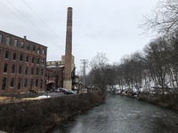 Image of Modern Day Simon Silk Mill
 This is the view of the silk mill from a close by bridge
-
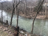 Photograph of Bushkill Creek from the Karl Stirner Arts Trail
 A view of the Bushkill Creek as one walks down the front end of the Karl Stirner Arts Trail.
-
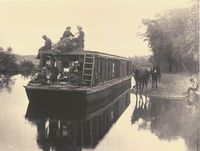 Molly Polly Chunker Boat
 These photos depict a trip taken down the Lehigh Canal. They detail how the canal was used recreationally by the public.
-
 Video and Recording of R & H Silk Mill and Dam Along the Bushkill Creek, Easton, PA
 With a brief sight of the R & H Silk Mill, the sound of the Bushkill Creek can be heard, along with the viewing of a small dam that is found just before the property of the mill.
-
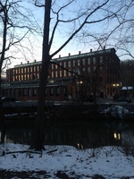 Photo of R & H Simon Silk Mill Along Bushkill Creek, Easton, PA
 This picture depicts an afternoon sight of one of the structures found within the chain of buildings located at the R & H Silk Mill.
-
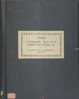 Field Notes, Recordings, and Mappings of Bushkill Creek, Easton, PA
 This item contains rough sketches of the Bushkill Creek, along with a number of notes taken by hand to accompany work done for a thesis. A detailed map of Bushkill Creek's water shed in included at the end.
-
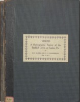 Record of Water Level Measurements and Daily Flow of Bushkill Creek, Easton, PA
 A detailed account with the objective of determining the variation of water heights within the Bushkill Creek was recorded through a series of notes written by typewriter.
-
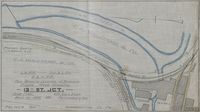 Bushkill Creek Planning Map for Location of Private Road Crossing, Easton, PA
 Being a hand drawn map, this map is found within a series of photos created by the Easton Office Division of Engineering.
-
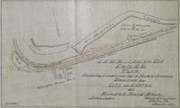 Bushkill Creek Planning Map for Road Crossing Planning Proposed by City of Easton, PA
 Being a hand drawn map, this map is found within a series of photos created by the Easton Office Division of Engineering.
-
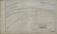 Bushkill Creek Planning Map for Location of Leased Land, Easton, PA
 Being a hand drawn map, this map is found within a series of photos created by the Easton Office Division of Engineering.
-
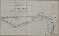 Bushkill Creek Planning Map for Cordage Works Right of Way, Easton, PA
 Being a hand drawn map, this map is found within a series of photos created by the Easton Office Division of Engineering.
-
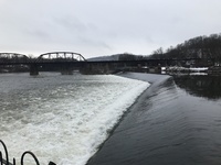 Image: Looking down the Easton Dam and Delaware River
 Photograph showing the distance across the Easton Dam and the angle it bends at to allow water to flow into the Delaware Canal.
-
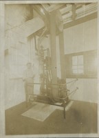 3 photo sequence of Mill Interior
First photo shows a man standing next to a large belt and wheels to which the man stands less than half the hight. The second photo shows a few men standing around open faced machinery that looks to be a part of the actual processing of the silk. The third photo shows a large open ballroom-esc part of the mill where women are doing some work by hand, and there looks to be seating for meetings or meals up on the right hand wall.
-
 Video of the Easton Dam showing upstream the Lehigh River and Downstream the Delaware River
 Video footage of the Easton Dam and surrounding area. It captures 180° showing upstream the Lehigh river and downstream the Delaware river and canal.
-
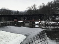 Image: Beginning of the Delaware Canal above the Easton Dam
 This photo depicts where water enters into the Delaware Canal from the Lehigh River at the top of the Easton Dam. A small bridge stretches across the top.
-
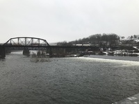 Image: Train Crossing the Delaware River alongside the Easton Dam
 A commercial train can be seen crossing the Delaware river. The bridge passes over the Easton dam and the entrance to the Delaware Canal.
-
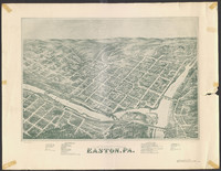 Image of a Hand Drawn Map (Ariel View) of Easton in 1873
 The infrastructure, water sources, and different types of landscapes are depicted in the hand drawn map.
-
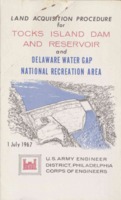 Brochure for the Land Acquisition Procedure for Tocks Island Dam and Reservoir by The U.S Army Corps of Engineers
 This information packet discusses how land will be secured by the government from the public for the creation of the Tocks Island Dam and Reservoir.
-
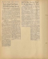 Tocks Island Scrapebook; Garbage Survey of Delaware River
 Article describes the efforts of the TIRAC to conduct a survey into the possible pollutant effects of the Tocks Island Project.
-
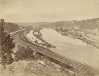 Photograph of the Canal and Railroad along the Lehigh River,
 This photo is taken looking upstream the Lehigh River and depicts the railroad, canal, and some buildings built along it.
-
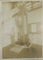 Silk Mill Interior Photographs
 This set of three photographs is associated with the autobiography written by Gus Meyner and show silk mill workers at the Simon Mill
-
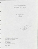 This is the Promised Land: The Saga of a Mill Family
 An autobiography written by Gus Meyner detailing his life growing up as a silk mill family. His family worked at the Simon Silk Mill in Easton, before moving to New Jersey
-
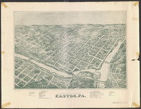 Hand drawn bird's eye view map of Easton, 1873
 This hand drawn map is a copy of the original two which hang in Easton and LC Libraries. It snapshots the downtown Easton Area and the fork of the Delaware and Lehigh Rivers, and covers as far back as Lafayette College where Pardee can be seen.
-
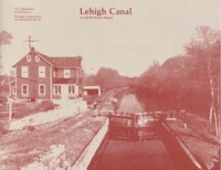 Lehigh Canal: An HCRS Project
 A 1979 study of the structures along the Lehigh Canal to be used for the revitalization of the Lehigh Canal Trail
 Video of Bushkill Creek from the Karl Stirner Arts Trail A moving image of the Bushkill Creek from the front end of the Karl Stirner Arts Trail. It encapsulates the scenery and sound from what is considered a recreational area.
 Image of Modern Day Simon Silk Mill This is the view of the silk mill from a close by bridge
 Photograph of Bushkill Creek from the Karl Stirner Arts Trail A view of the Bushkill Creek as one walks down the front end of the Karl Stirner Arts Trail.
 Molly Polly Chunker Boat These photos depict a trip taken down the Lehigh Canal. They detail how the canal was used recreationally by the public.
 Video and Recording of R & H Silk Mill and Dam Along the Bushkill Creek, Easton, PA With a brief sight of the R & H Silk Mill, the sound of the Bushkill Creek can be heard, along with the viewing of a small dam that is found just before the property of the mill.
 Photo of R & H Simon Silk Mill Along Bushkill Creek, Easton, PA This picture depicts an afternoon sight of one of the structures found within the chain of buildings located at the R & H Silk Mill.
 Field Notes, Recordings, and Mappings of Bushkill Creek, Easton, PA This item contains rough sketches of the Bushkill Creek, along with a number of notes taken by hand to accompany work done for a thesis. A detailed map of Bushkill Creek's water shed in included at the end.
 Record of Water Level Measurements and Daily Flow of Bushkill Creek, Easton, PA A detailed account with the objective of determining the variation of water heights within the Bushkill Creek was recorded through a series of notes written by typewriter.
 Bushkill Creek Planning Map for Location of Private Road Crossing, Easton, PA Being a hand drawn map, this map is found within a series of photos created by the Easton Office Division of Engineering.
 Bushkill Creek Planning Map for Road Crossing Planning Proposed by City of Easton, PA Being a hand drawn map, this map is found within a series of photos created by the Easton Office Division of Engineering.
 Bushkill Creek Planning Map for Location of Leased Land, Easton, PA Being a hand drawn map, this map is found within a series of photos created by the Easton Office Division of Engineering.
 Bushkill Creek Planning Map for Cordage Works Right of Way, Easton, PA Being a hand drawn map, this map is found within a series of photos created by the Easton Office Division of Engineering.
 Image: Looking down the Easton Dam and Delaware River Photograph showing the distance across the Easton Dam and the angle it bends at to allow water to flow into the Delaware Canal.
 3 photo sequence of Mill Interior
First photo shows a man standing next to a large belt and wheels to which the man stands less than half the hight. The second photo shows a few men standing around open faced machinery that looks to be a part of the actual processing of the silk. The third photo shows a large open ballroom-esc part of the mill where women are doing some work by hand, and there looks to be seating for meetings or meals up on the right hand wall.
 Video of the Easton Dam showing upstream the Lehigh River and Downstream the Delaware River Video footage of the Easton Dam and surrounding area. It captures 180° showing upstream the Lehigh river and downstream the Delaware river and canal.
 Image: Beginning of the Delaware Canal above the Easton Dam This photo depicts where water enters into the Delaware Canal from the Lehigh River at the top of the Easton Dam. A small bridge stretches across the top.
 Image: Train Crossing the Delaware River alongside the Easton Dam A commercial train can be seen crossing the Delaware river. The bridge passes over the Easton dam and the entrance to the Delaware Canal.
 Image of a Hand Drawn Map (Ariel View) of Easton in 1873 The infrastructure, water sources, and different types of landscapes are depicted in the hand drawn map.
 Brochure for the Land Acquisition Procedure for Tocks Island Dam and Reservoir by The U.S Army Corps of Engineers This information packet discusses how land will be secured by the government from the public for the creation of the Tocks Island Dam and Reservoir.
 Tocks Island Scrapebook; Garbage Survey of Delaware River Article describes the efforts of the TIRAC to conduct a survey into the possible pollutant effects of the Tocks Island Project.
 Photograph of the Canal and Railroad along the Lehigh River, This photo is taken looking upstream the Lehigh River and depicts the railroad, canal, and some buildings built along it.
 Silk Mill Interior Photographs This set of three photographs is associated with the autobiography written by Gus Meyner and show silk mill workers at the Simon Mill
 This is the Promised Land: The Saga of a Mill Family An autobiography written by Gus Meyner detailing his life growing up as a silk mill family. His family worked at the Simon Silk Mill in Easton, before moving to New Jersey
 Hand drawn bird's eye view map of Easton, 1873 This hand drawn map is a copy of the original two which hang in Easton and LC Libraries. It snapshots the downtown Easton Area and the fork of the Delaware and Lehigh Rivers, and covers as far back as Lafayette College where Pardee can be seen.
 Lehigh Canal: An HCRS Project A 1979 study of the structures along the Lehigh Canal to be used for the revitalization of the Lehigh Canal Trail