-
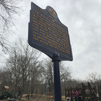 Historical Marker of the Lehigh Canal
 A historical marker of the Lehigh Canal at the entrance of the park. It is from the Pennsylvania Historical and Museum Commision in 1995 and gives a short description of the canal and its significance.
-
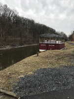 Docked Canal Boat
 A modern construction of a canal boat, used for recreational purposes during the summer months for tourists.
-
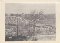 Photo of Bridge from Forks and Delware Photo Album
 This image shows the Delware River Toll Bridge in the mid 1900s. The image was taken out of a much larger photo album with very similar pieces of work.
-
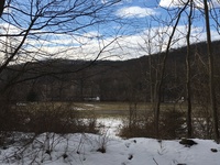 Basketball courts at Tocks Island
 Paved recreation park inside the actual National Park, including basketball courts, children playgrounds and bathrooms.
-
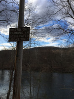 Park Sign by Tocks Island
 The scenery of the Water Gap is broken up by an official park sign asking visitors to park in designated areas.
-
 Video of Tocks Island
 Panoramic video of Tocks Island shot from Old Mine Road, immediately adjacent to the Delaware River.
-
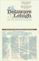 National Heritage Corridor, ‘Conservation Efforts of the Delaware and Lehigh Canal
 This depicts the importance of preserving the canal and the nation’s industrial and cultural heritage. This document argues in favor of conservation and how it will benefit the public.
-
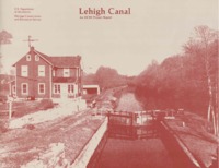 Heritage, Conservation, and Recreation Service, ‘A Report on the Lehigh Canal
 The plans in the report are prototypes to be considered and detail community, industrial, and recreational uses for the canal and the surrounding area. This report is a proposal for how the government should preserve the area.
-
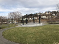 Amphitheater in Scott Park
 View from stands in amphitheater in Scott Park. There are two of amphitheaters and this is the smaller one closer to the water.
-
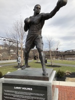 Picture of Larry Holmes Statue
 Picture of Larry Holmes statue in Scott Park.
-
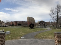 Easton View from River Outlook
 This is an image of the view of Easton from the fork between the Lehigh and Delaware River look out.
-
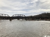 Photo of bridge and Fork of Delaware and Lehigh Rivers
 This is a photo showing the bridge from the corner of Easton. The image includes part of a small dam and the intersection of Lehigh and Delaware Rivers.
-
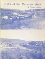 Photo album of Delaware and Lehigh River fork.
 Album of photos taken of areas around the Delaware and Lehigh River during the 1960s
-
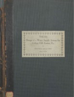 Design of Water Supply System for College Hill, Easton PA
 Design work up of the water supply for college hill. Includes blue prints as well as written decriptions
-
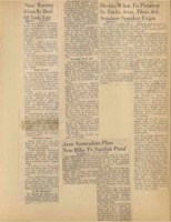 Tocks Island Scrapebook; Naturalist Call to Action
 Article is a general call to the public to show support for nature conservation. Local naturalists plan hike to protest the damming of the Delaware River to create the Tocks Island Recreational Area.
-
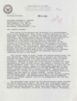 Letter from Corp of Engineers to Reibman
 Letter stating the Army Corp of Engineers plan for studying the Lehigh River Basin. Sent to Senator Reibman.
-
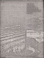 Government Proposal for Tocks Island Recreation Area
 Official government proposal with points and arguments on the various reasons why the Tocks Island Project should be passed through Congress. Including economic, conservation and recreational values.
-
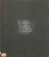 A Sanctuary Survey of the Delaware River and its Tributaries
 A student thesis describing a survey that measures the pumping station at Easton and the Delaware Water Gap.
 Historical Marker of the Lehigh Canal A historical marker of the Lehigh Canal at the entrance of the park. It is from the Pennsylvania Historical and Museum Commision in 1995 and gives a short description of the canal and its significance.
 Docked Canal Boat A modern construction of a canal boat, used for recreational purposes during the summer months for tourists.
 Photo of Bridge from Forks and Delware Photo Album This image shows the Delware River Toll Bridge in the mid 1900s. The image was taken out of a much larger photo album with very similar pieces of work.
 Basketball courts at Tocks Island Paved recreation park inside the actual National Park, including basketball courts, children playgrounds and bathrooms.
 Park Sign by Tocks Island The scenery of the Water Gap is broken up by an official park sign asking visitors to park in designated areas.
 Video of Tocks Island Panoramic video of Tocks Island shot from Old Mine Road, immediately adjacent to the Delaware River.
 National Heritage Corridor, ‘Conservation Efforts of the Delaware and Lehigh Canal This depicts the importance of preserving the canal and the nation’s industrial and cultural heritage. This document argues in favor of conservation and how it will benefit the public.
 Heritage, Conservation, and Recreation Service, ‘A Report on the Lehigh Canal The plans in the report are prototypes to be considered and detail community, industrial, and recreational uses for the canal and the surrounding area. This report is a proposal for how the government should preserve the area.
 Amphitheater in Scott Park View from stands in amphitheater in Scott Park. There are two of amphitheaters and this is the smaller one closer to the water.
 Picture of Larry Holmes Statue Picture of Larry Holmes statue in Scott Park.
 Easton View from River Outlook This is an image of the view of Easton from the fork between the Lehigh and Delaware River look out.
 Photo of bridge and Fork of Delaware and Lehigh Rivers This is a photo showing the bridge from the corner of Easton. The image includes part of a small dam and the intersection of Lehigh and Delaware Rivers.
 Photo album of Delaware and Lehigh River fork. Album of photos taken of areas around the Delaware and Lehigh River during the 1960s
 Design of Water Supply System for College Hill, Easton PA Design work up of the water supply for college hill. Includes blue prints as well as written decriptions
 Tocks Island Scrapebook; Naturalist Call to Action Article is a general call to the public to show support for nature conservation. Local naturalists plan hike to protest the damming of the Delaware River to create the Tocks Island Recreational Area.
 Letter from Corp of Engineers to Reibman Letter stating the Army Corp of Engineers plan for studying the Lehigh River Basin. Sent to Senator Reibman.
 Government Proposal for Tocks Island Recreation Area Official government proposal with points and arguments on the various reasons why the Tocks Island Project should be passed through Congress. Including economic, conservation and recreational values.
 A Sanctuary Survey of the Delaware River and its Tributaries A student thesis describing a survey that measures the pumping station at Easton and the Delaware Water Gap.