-
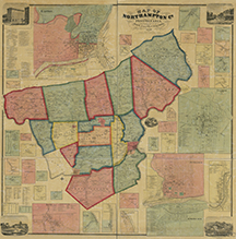 Map of Northampton Co., Pennsylvania : from actual surveys
 Map of Northampton County with multiple large scale inset maps of town centers including a large inset map of the City of Easton. The map also includes statistical tables and illustrations of selected buildings.
-
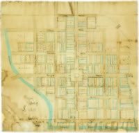 Original Plan of Easton
 Hand drawn map showing original streets and plot owners of downtown Easton in the late eighteenth century.
-
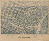 Bird's Eye View of Easton, PA. 1873
 A Bird's Eye View map showing Easton and parts of South Easton and Phillipsburg, NJ, includes reference keys for selected public and commercial buildings
-
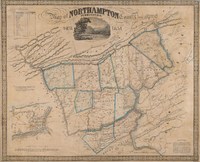 Map of Northampton County Pennsylvania 1851
 Map of Northampton County and surrounding features including the Blue Mountains, parts of Warren County, NJ and the Delaware and Lehigh Water Gaps, large scale inset map of Easton, PA.
-
 Plan of Easton [1789]
 Cadastral map of the Town of Easton
-
Plan of the Town of Easton
Map of the City of Easton and South Easton, Northampton County, Pennsylvania
-
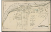 Borough of South Easton
 Map of the Borough of South Easton, Northampton Country, Pennsylvania, Philadelphia:
-
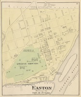
 Plan of Easton Part of 7th Ward
 Map of the City of Easton's 7th Ward, Northampton County, Pennsylvania
-
 Plan of Easton Showing the Part of 3rd Ward
 Map of the City of Easton's 3th Ward, Northampton County, Pennsylvania
-
 Plan of Easton Showing the 6th Ward
 Map of the City of Easton's 6th Ward, Northampton County, Pennsylvania
-
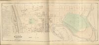
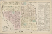 Plan of Easton Showing the 1st, 2nd, 4th, & 5th Wards
 Map of the City of Easton showing the 1st, 2nd, 4th, and 5th Wards, Northampton County, Pennsylvania,
-
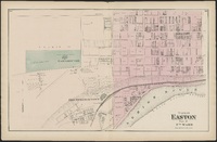
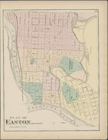 Plan of Easton
 Map of the City of Easton, Northampton County, Pennsylvania
-
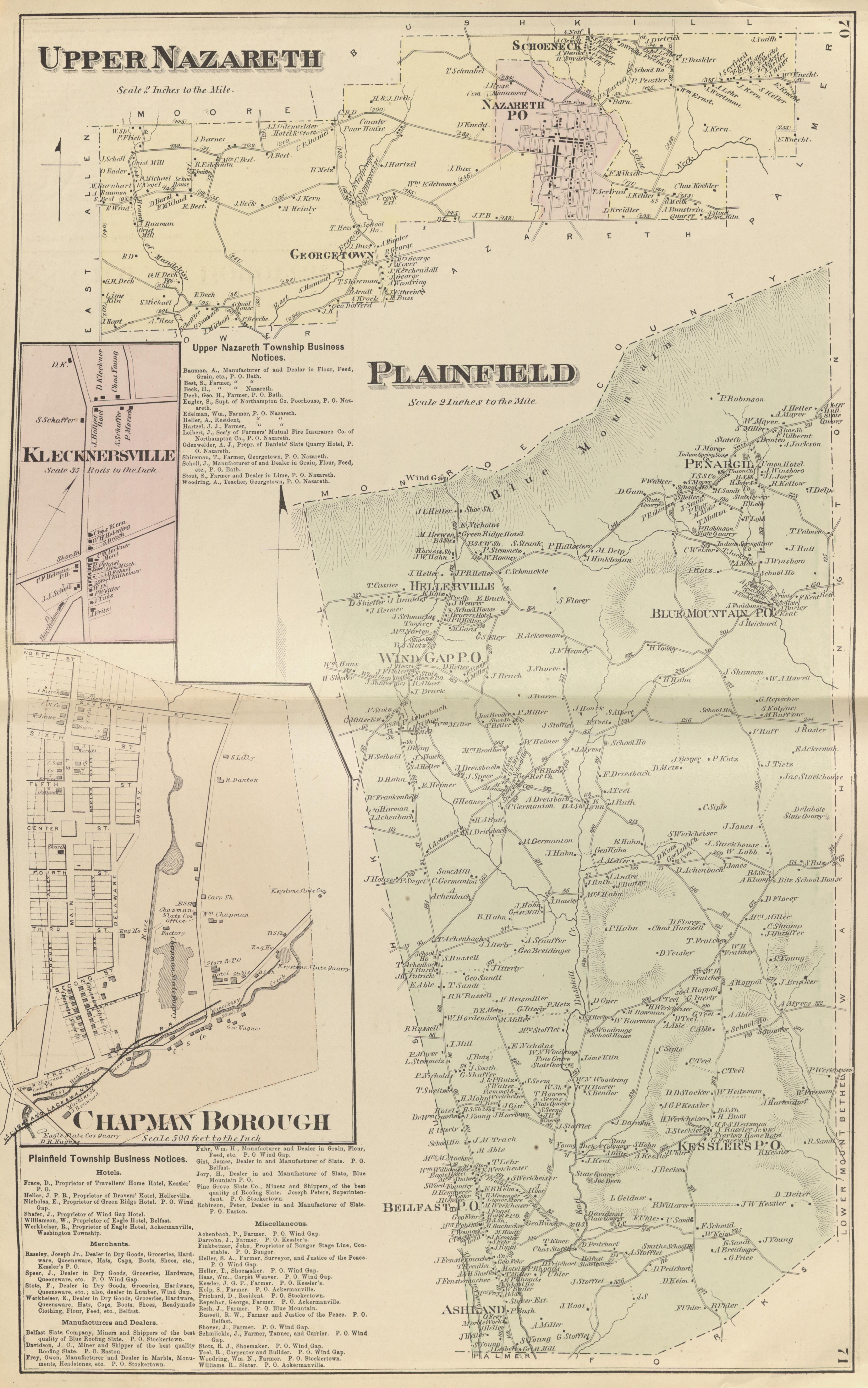 Upper Nazareth, Plainfield, Klecknersville, Chapman Borough
 Four maps showing Upper Nazareth, Plainfield, Klecknersville, and Chapman Borough, Northampton County, Pennsylvania,
-
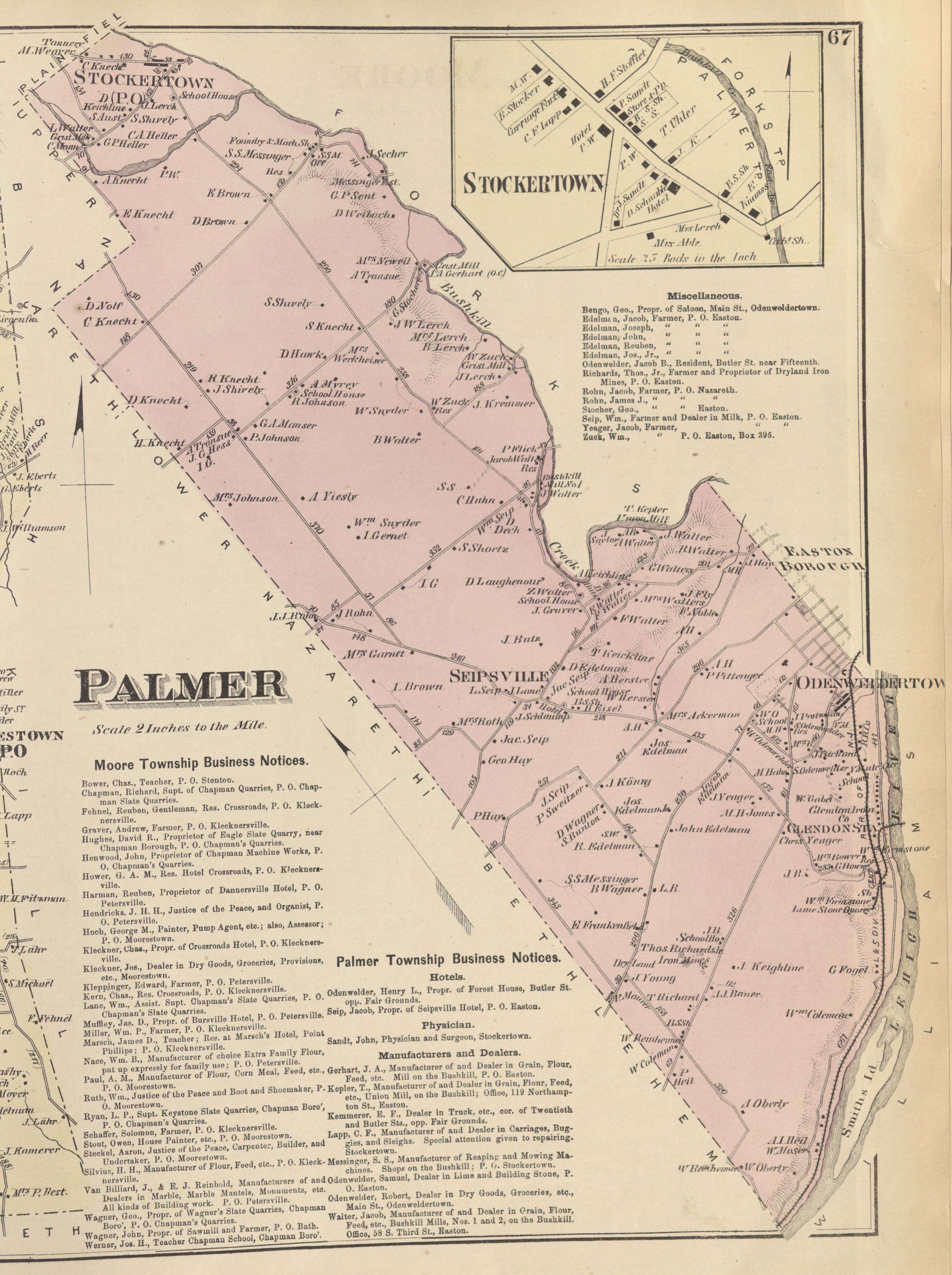 Palmer, Stockertown
 Two Maps showing Palmer Township and Borough of Stockertown, Northampton County, Pennsylvania
-
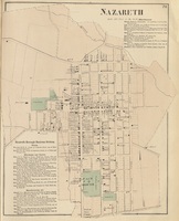 Nazareth
 Map of Nazareth, Northampton County, Pennsylvania
-
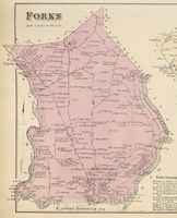 Forks
Forks Map of Forks Township,Northampton County, Pennsylvania
-
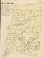 Bushkill
 Map of Bushkill Township, Northampton County, Pennsylvania
-
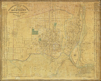
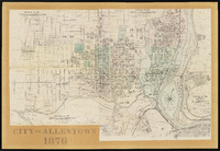 A Portion of the City of Allentown
 Map has been assembled from 4 pages taken from F.A. Davis' New illustrated atlas of Lehigh County, Pennsylvania.
-
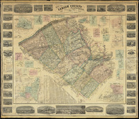 Map of Lehigh County, Pennsylvania
 Includes 24 plans of boroughs and cities, 31 town and home views, a Table of distances, a Statistical table of Lehigh County and Historical Notes of Lehigh County.
-
 Topographical and Property Map of the City of Allentown and the Surrounding Territory.
 Detailed street map showing 6 wards, with a list of property owners by ward on the left and right edges.