
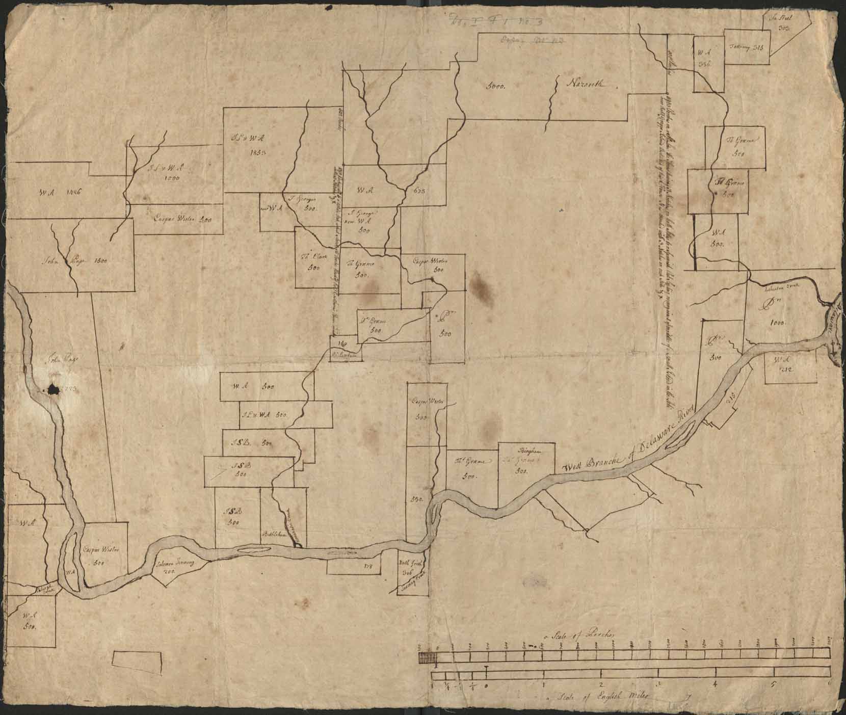
[Cadastral map of Lehigh Valley lands between Allentown, Bethlehem, Nazareth, and Easton]
Item
- Title
- [Cadastral map of Lehigh Valley lands between Allentown, Bethlehem, Nazareth, and Easton]
- Creator
- Unknown
- Date
- circa 1742
- Description
- Cadastral map showing land holdings along the Lehigh River.
- Is Part Of
- Collection of Drawings and Prints
- https://www.moravianchurcharchives.findbuch.net/php/main.php#4450
- Spatial Coverage
- Northampton County, Pennsylvania
- Provenance
- Moravian Archives, Bethlehem, Pennsylvania
- Rights
- Please consult Rights and Re-Use Policy of the Moravian Archives.
- https://www.moravianchurcharchives.org/about/#tabs-10
- Item sets
- Historical Maps of the Lehigh Valley
- Media
 DP_f_018_6.jpg