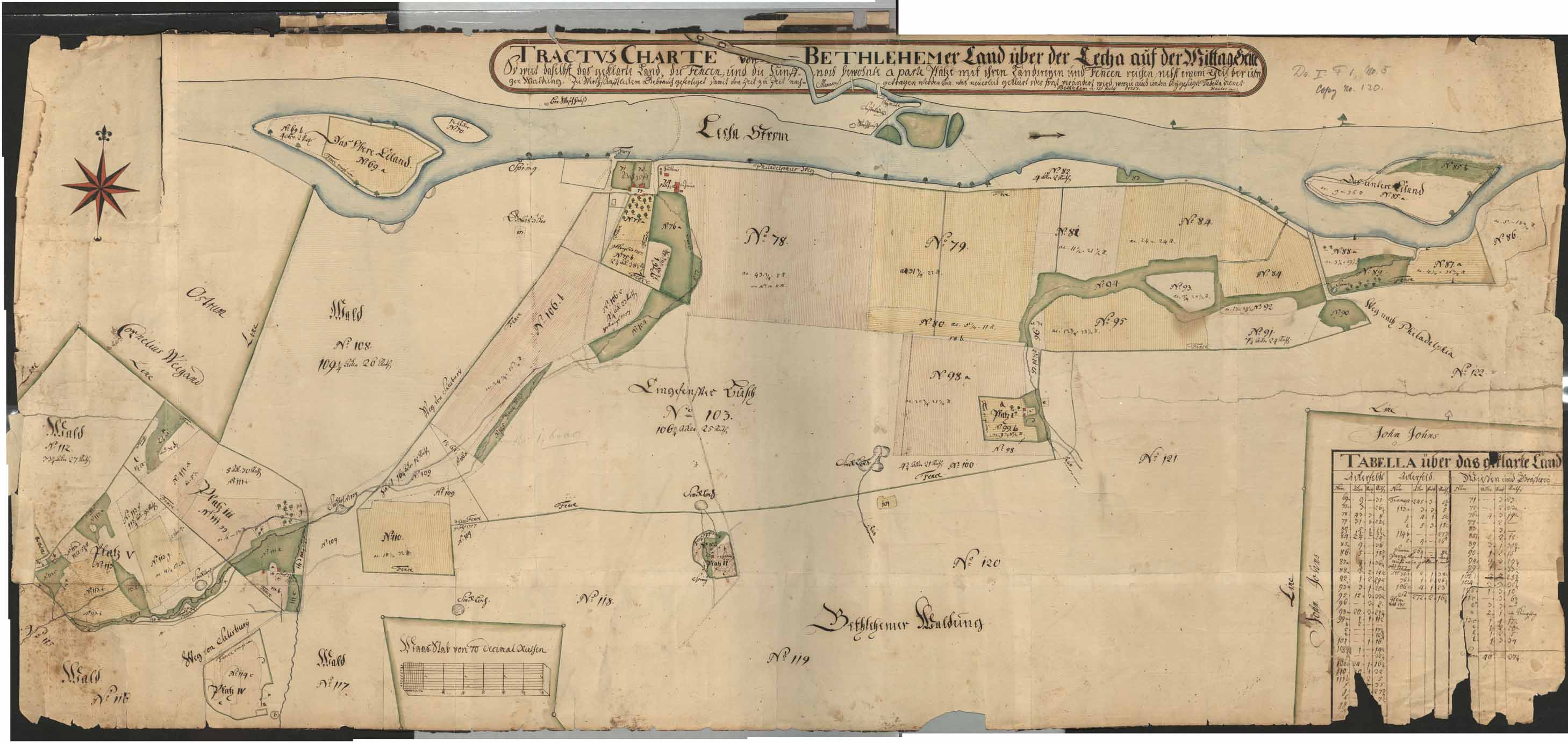
[Plat map of Bethlehem lands on the south side of the Lehigh River]
Item
-
Title
-
[Plat map of Bethlehem lands on the south side of the Lehigh River]
-
Creator
-
Philipp Christian Gottlieb Reuter
-
Date
-
1757
-
Description
-
Tractus-Charte von Bethlehem Land über der Lecha auf der Mittag-Seite; a cadastral map of South Bethlehem and surrounding area, indicating properties owned by the Moravian Church and others; prepared by a Moravian surveyor.
-
Spatial Coverage
-
Bethlehem, Northampton County, Pennsylvania
-
Provenance
-
Moravian Archives, Bethlehem, Pennsylvania

 DP_f_019_3.jpg