
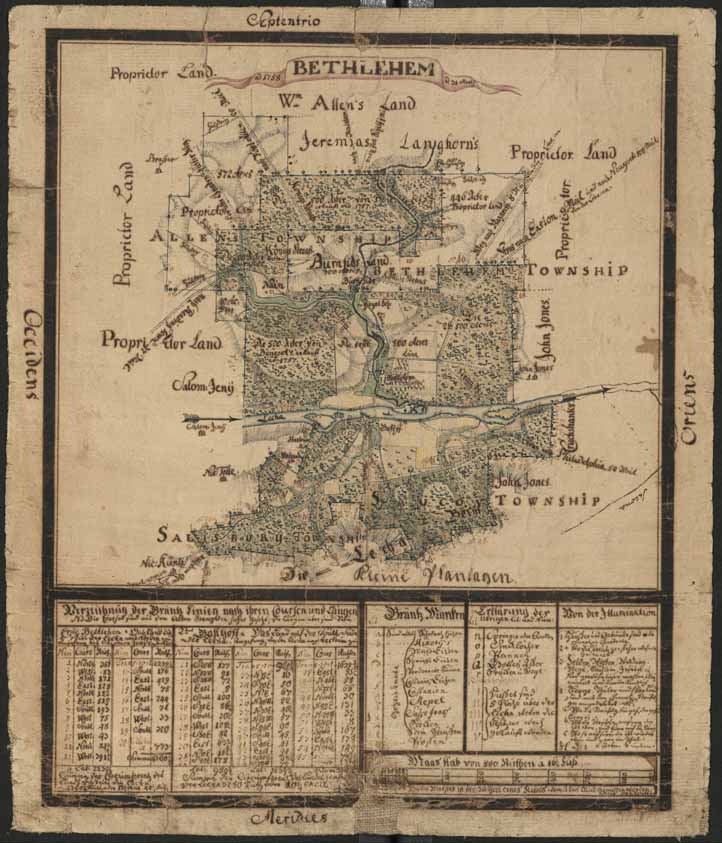
[Topographic map of Bethlehem, Pennsylvania, and surrounding tracts]
Item
- Title
- [Topographic map of Bethlehem, Pennsylvania, and surrounding tracts]
- Creator
- Philipp Christian Gottlieb Reuter
- Date
- 1758
- Description
- Map of Bethlehem Tract and adjacent lands, prepared by a Moravian surveyor.
- Is Part Of
- Collection of Drawings and Prints
- https://www.moravianchurcharchives.findbuch.net/php/main.php#4450
- Spatial Coverage
- Bethlehem, Northampton County, Pennsylvania
- Provenance
- Moravian Archives, Bethlehem, Pennsylvania
- Rights
- Please consult Rights and Re-Use Policy of the Moravian Archives.
- https://www.moravianchurcharchives.org/about/#tabs-10
- Item sets
- Historical Maps of the Lehigh Valley
- Media
 DP_f_224_2.jpg