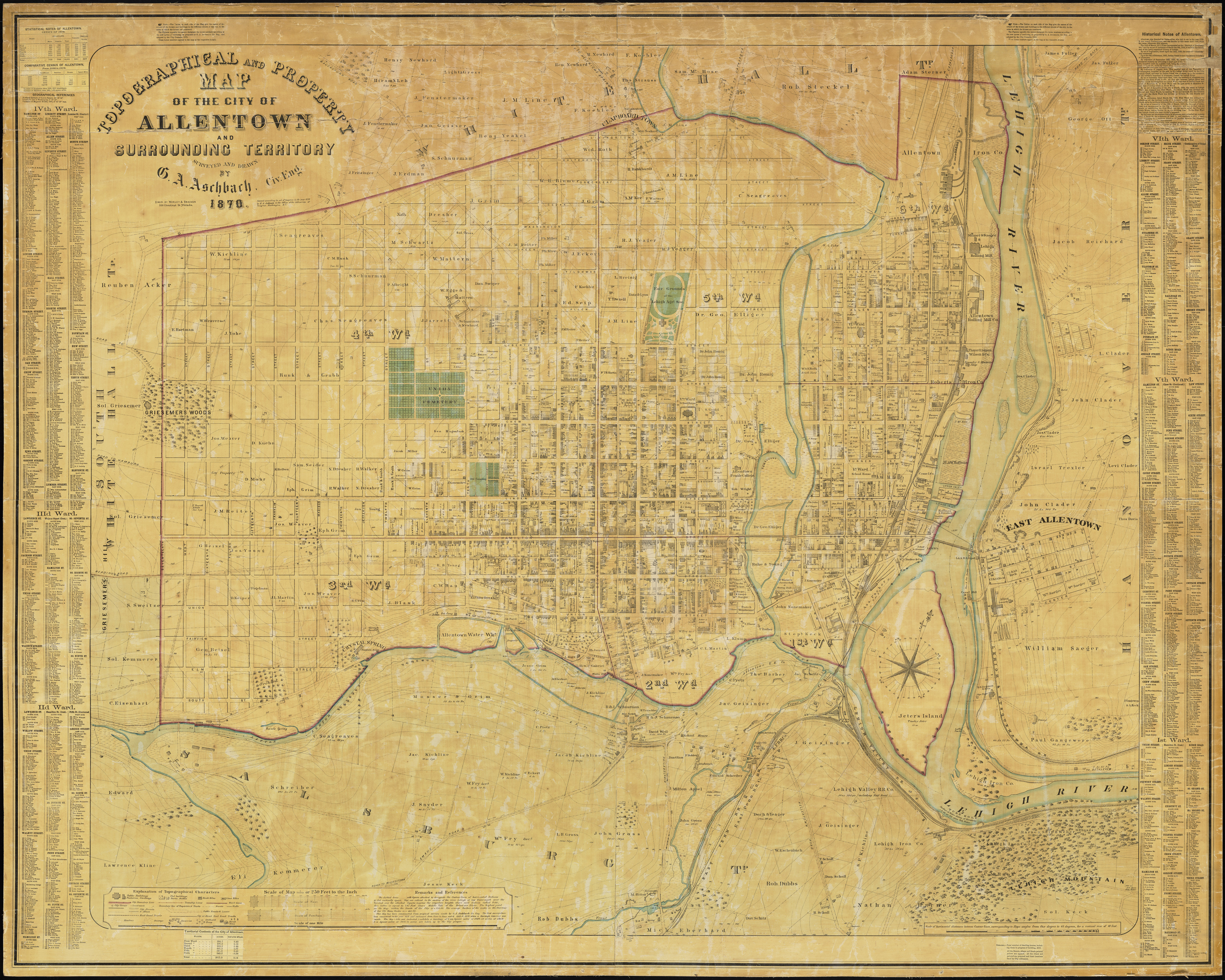
Topographical and Property Map of the City of Allentown and the Surrounding Territory.
Item
-
Title
-
Topographical and Property Map of the City of Allentown and the Surrounding Territory.
-
Creator
-
G. A. Aschbach
-
Date
-
1870
-
Description
-
Detailed street map showing 6 wards, with a list of property owners by ward on the left and right edges.
-
Publisher
-
Philadelphia: G. A. Aschbach
-
Spatial Coverage
-
Allentown, Pennsylvania
-
Rights
-
Images are in the public domain and are made openly available by Trexler Library. When reproducing an image from the Ray R. Brennen Map Collection, please credit "Special Collections and Archives, Trexler Library. Muhlenberg College." High-resolution images are available upon request. While there are no restrictions or conditions on the use of these images, Trexler Library would appreciate a gratis copy of any scholarly publications in which the images are used.

 Brennan_PA06.jpg


