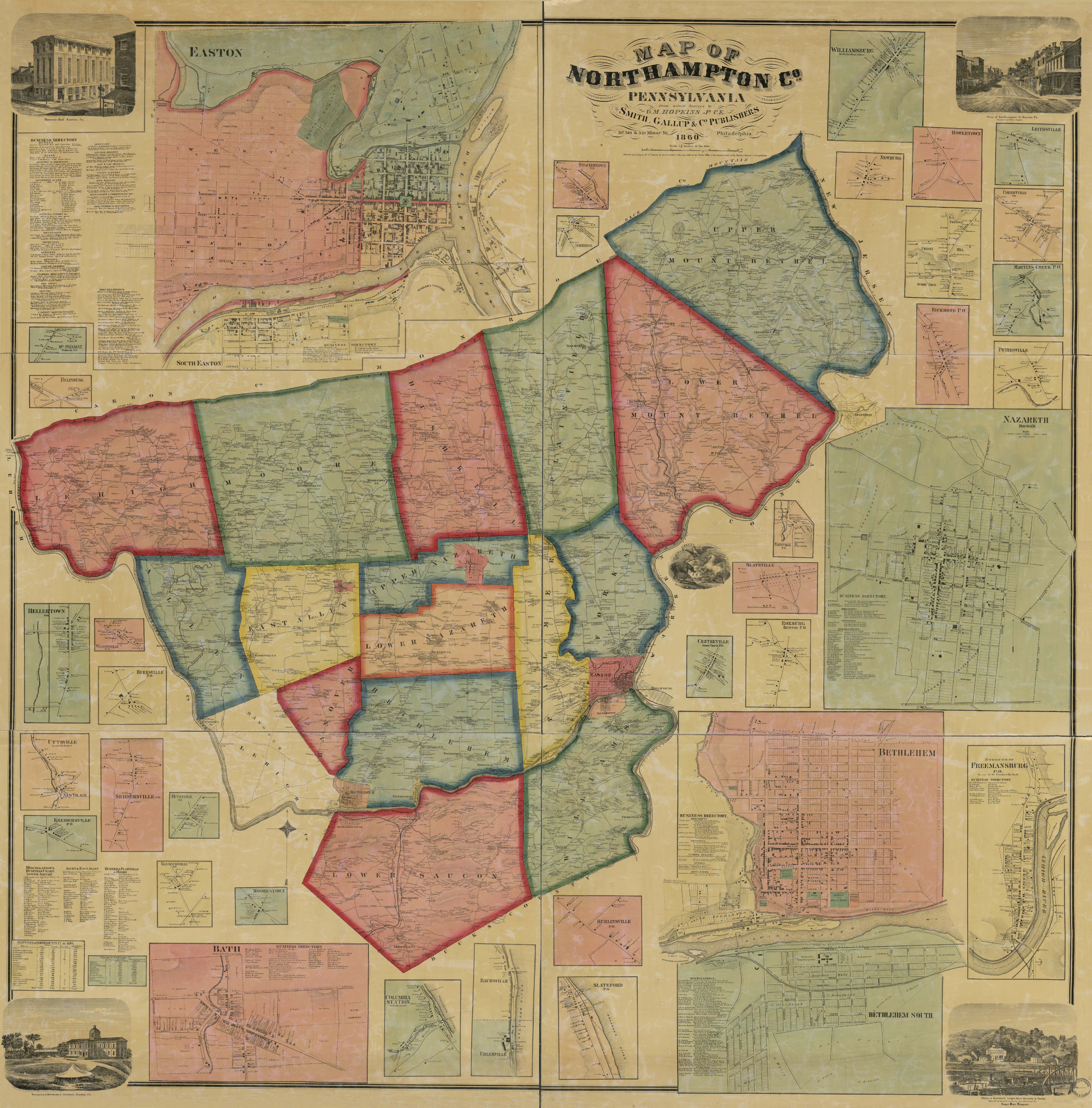
Map of Northampton Co., Pennsylvania : from actual surveys
Item
-
Title
-
Map of Northampton Co., Pennsylvania : from actual surveys
-
Creator
-
Hopkins, G.M.
-
Date
-
1860
-
Description
-
Map of Northampton County with multiple large scale inset maps of town centers including a large inset map of the City of Easton. The map also includes statistical tables and illustrations of selected buildings.
-
Publisher
-
Philadelphia: Smith, Gallup & Co.
-
Spatial Coverage
-
Northampton County, Easton, Bath, Bethlehem, Freemansburg, Centerville, Stone Church P.O., Roxburg, Boston P.O., Slateville, Flecksville P.O.,
-
Provenance
-
Geography & Map Division, Library of Congress