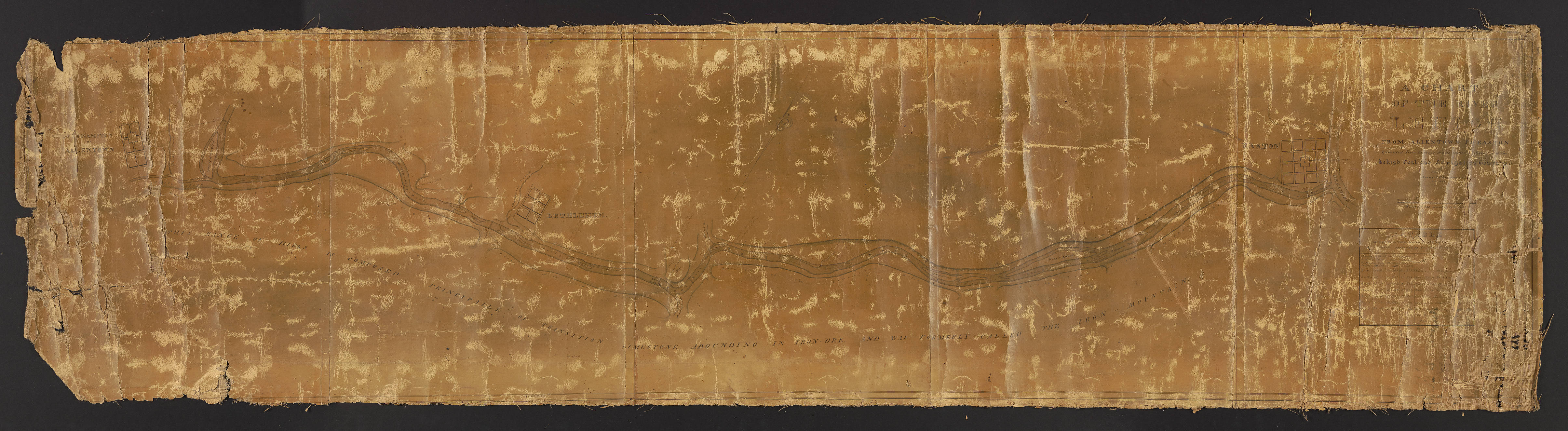
Allentown to Easton: A Chart of the River Lehigh from Allentown to Easton
Item
-
Title
-
Allentown to Easton: A Chart of the River Lehigh from Allentown to Easton
-
Creator
-
Isaac Chapman
-
Date
-
1826
-
Description
-
An engineering survey of the Lehigh River from Allentown to Easton made under the direction of the Lehigh Coal and Navigation Company in preparation for canal construction. In the bottom right corner of the map is a table detailing the fall of the river from Mauch Chunk to Easton. Locations of limestone ridges, hills, and nobs are also featured.
-
Publisher
-
Easton, Pa. : Lehigh Coal and Navigation Company
-
Spatial Coverage
-
Easton (Northampton County, Pa.) ; Allentown (Pa.) ; Bethlehem (Pa.) ; Northampton (Pa.)
-
Provenance
-
Lehigh University

 Lehigh_1.jpg