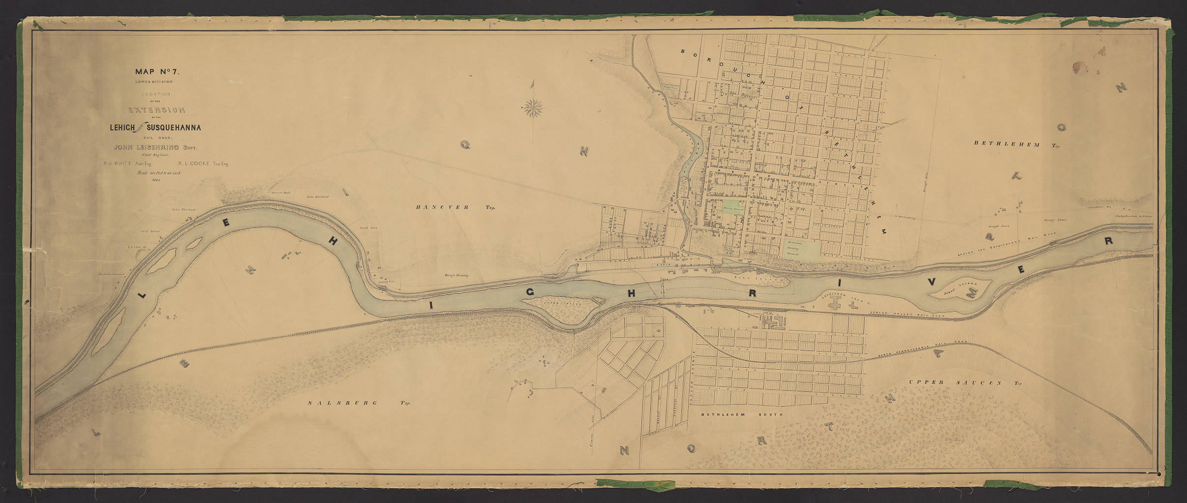
Map No. 7. Lower Division. Location of the Extension of the Lehigh and Susquehanna Rail Road.
Item
-
Title
-
Map No. 7. Lower Division. Location of the Extension of the Lehigh and Susquehanna Rail Road.
-
Creator
-
C. M. Babcock; R.L. Cooke; John Leisenring
-
Date
-
1862
-
Description
-
From a series of 9 maps, detailing the Lehigh and Susquehanna Railroad running alongside the Lehigh River from Mauch Chunk to Easton. These maps also include surveying information on local landowners, towns, and cities.
-
Publisher
-
Easton, Pa. : Lehigh Coal and Navigation Company
-
Spatial Coverage
-
Mauch Chunk (Pa.) ; Weissport (Pa.) ; Mahoning (Carbon County, Pa. : Township) ; Franklin (Carbon County, Pa. : Township) ; Lower Towamensing (Pa. : Township) ; Lehigh County (Pa.) ; Northampton County (Pa.) ; Washington (Lehigh County, Pa. : Township) ; Lehigh (Northampton County, Pa. : Township) ; Slatington (Pa.) ; Walnutport (Pa.) ; North Whitehall (Pa. : Township) ; Allen (Northampton County, Pa. : Township) ; Lockport (Pa.) ; Coplay (Pa.) ; Hokendauqua (Pa.) ; Whitehall (Pa. : Township) ; Hanover (Lehigh County, Pa. : Township) ; South Whitehall (Pa. : Township) ; Salisbury (Lehigh County, Pa. : Township) ; Allentown (Pa.) ; Catasauqua (Pa.) ; Bethlehem (Pa.) ; Bethlehem (Northampton County, Pa. : Township) ; Lower Saucon (Pa. : Township) ; New Jersey ; Forks (Northampton County, Pa. : Township) ; Williams (Northampton County, Pa. : Township) ; Easton (Northampton County, Pa.) ; Phillipsburg (N.J.) ; West Easton (Pa.)
-
Provenance
-
Lehigh University

 Lehigh_13.jpg