
Map of land holdings along the Lehigh River
Item
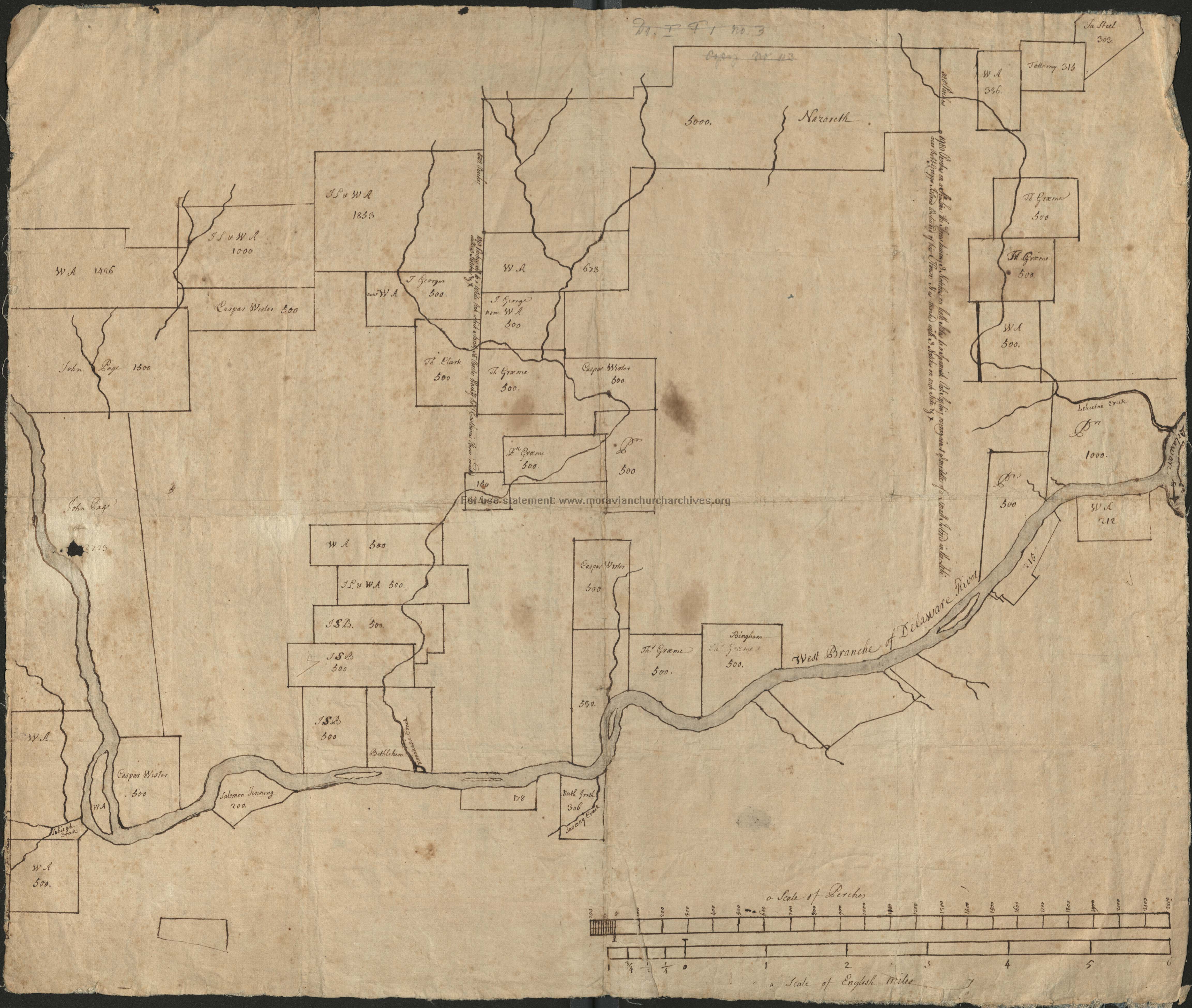
- Title
- Map of land holdings along the Lehigh River
- Creator
- Unknown
- Date
- circa 1742
- Description
- A pen-on-paper, linen-backed, map of the land holdings from modern-day Northampton to Easton.
- Is Part Of
- Collection of Drawings and Prints
- Spatial Coverage
- Lehigh Valley, Pennsylvania
- Provenance
- Moravian Archives, Bethlehem, Pennsylvania
- Rights
- Please consult Rights and Re-Use Policy of the Moravian Archives.
- https://www.moravianchurcharchives.org/about/#tabs-10
- Item sets
- Historical Maps of the Lehigh Valley
- Site pages
- Digital Map Collections
- Media
 DP_f_018_6.jpg