Plan for the future town of Easton, Pennsylvania
Item
-
Title
-
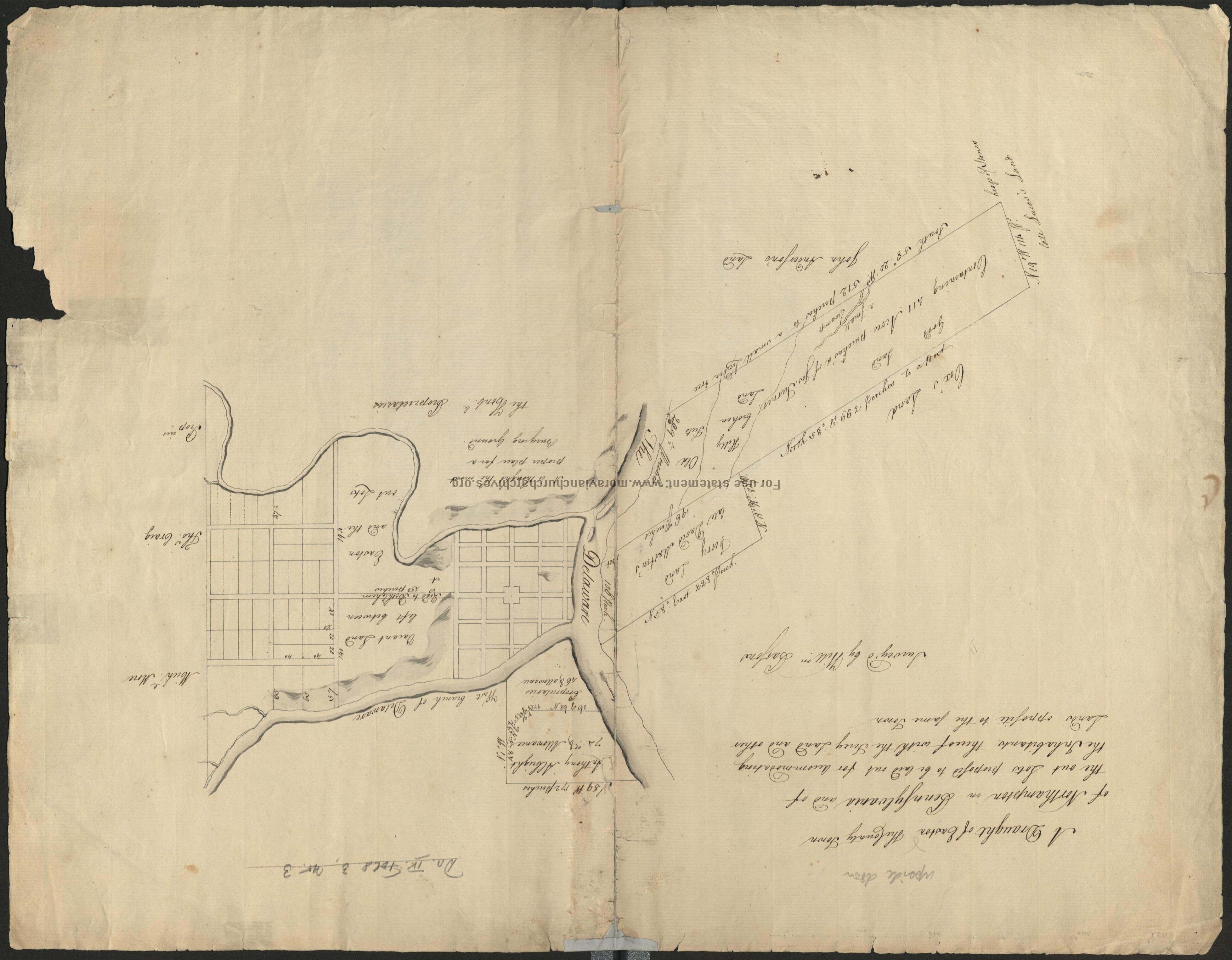
Plan for the future town of Easton, Pennsylvania
-
Creator
-
William Parsons, surveyor
-
Date
-
circa 1753
-
Description
-
A cadastral map showing land parcels for sale in Easton. William Parsons was an agent for the Penns, acting for them during, and after the establishment of Easton in 1752. Note that the map is oriented with South at the top.
-
Is Part Of
-
Collection of Drawings and Prints
-
Spatial Coverage
-
Easton, Northampton County, Pennsylvania
-
Provenance
-
Moravian Archives, Bethlehem, Pennsylvania

 DP_f_032_5.jpg