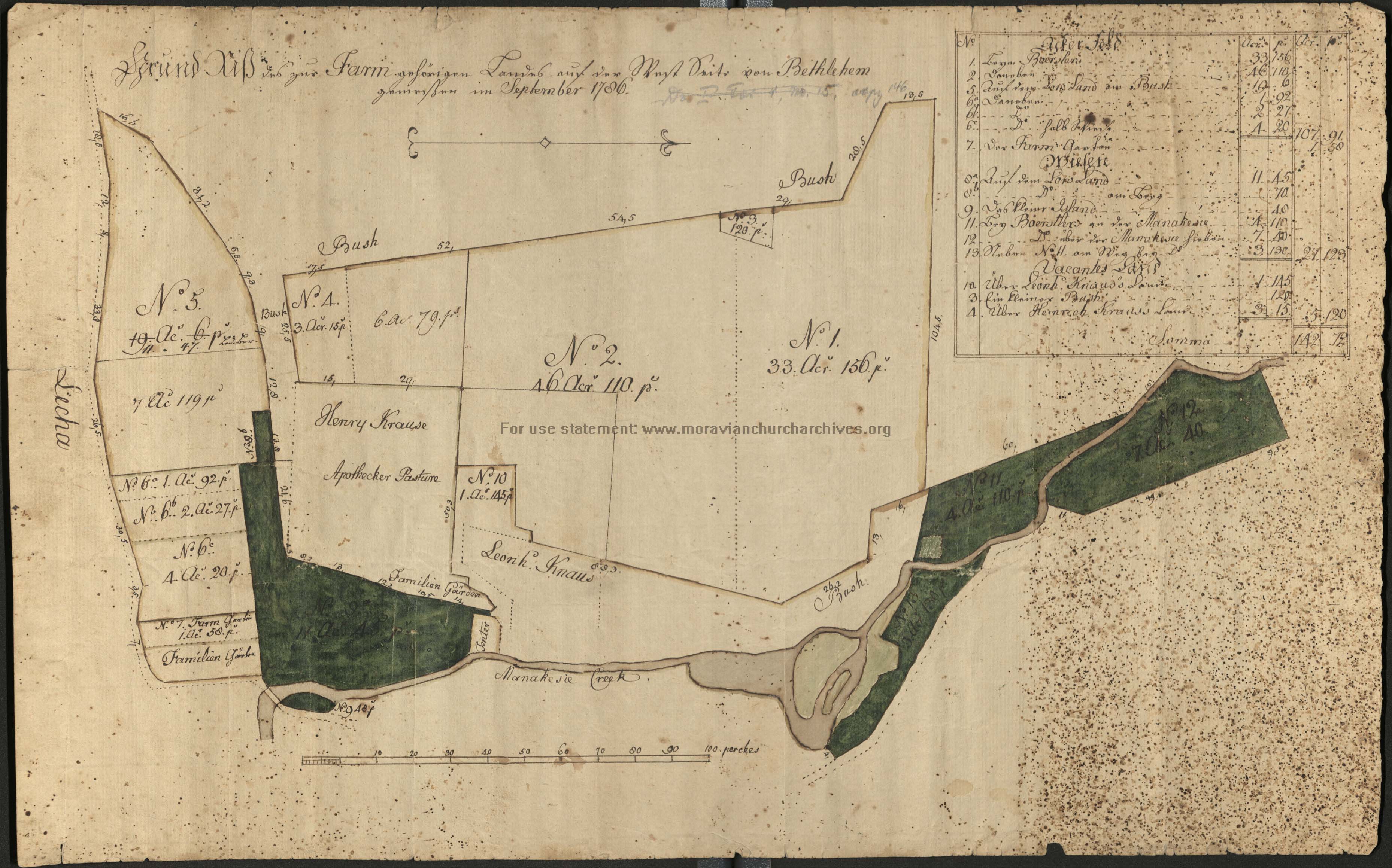
[Plan of the Farmlands west of Bethlehem, 1786]
Item
-
Title
-
[Plan of the Farmlands west of Bethlehem, 1786]
-
Creator
-
[Georg Wenzeslaus Golkowsky]
-
Date
-
1786
-
Description
-
Full title: Grund Riß des zur Farm gehörigen Landes auf der West Seite von Bethlehem [Plan of the farmlands on the west side of Bethlehem, north of the Lehigh River, west of the Monocacy Creek] A manuscript map drawn by a surveyor from the Moravian community.
-
Is Part Of
-
Collection of Drawings and Prints
-
Spatial Coverage
-
Bethlehem, Northampton County, Pennsylvania
-
Provenance
-
Moravian Archives, Bethlehem, Pennsylvania

 DP_f_023_3.jpg