Map of the Nazareth Tract
Item
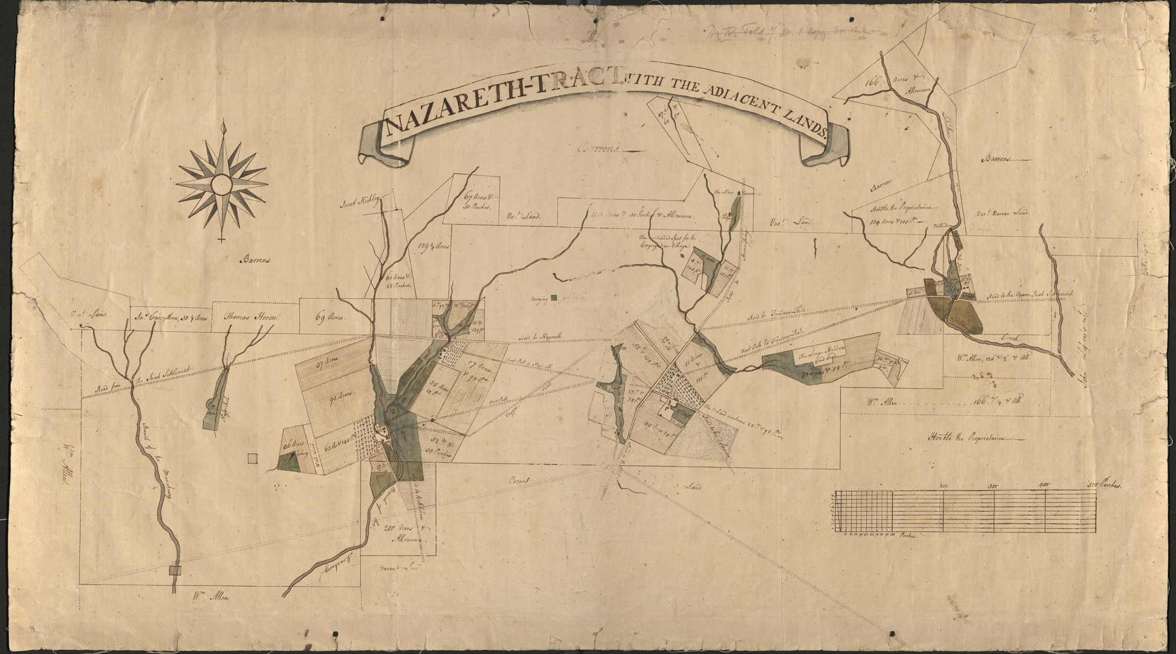
- Title
- Map of the Nazareth Tract
- Alternative Title
- Nazareth-Tract with the Adjacent Lands
- Creator
- Nicholas Garrison and Georg Wenzeslaus Golkowsky
- Date
- 1755
- Description
- Cadastral map of the 5000-acre "Nazareth Tract," with some adjacent properties. Pen-on-paper map prepared by a Moravian surveyor and a Moravian ship captain. Date Approximate.
- Is Part Of
- Collection of Drawings and Prints
- Spatial Coverage
- Nazareth, Northampton County, Pennsylvania
- Provenance
- Moravian Archives, Bethlehem, Pennsylvania
- Item sets
- Historical Maps of the Lehigh Valley
- Site pages
- Digital Map Collections