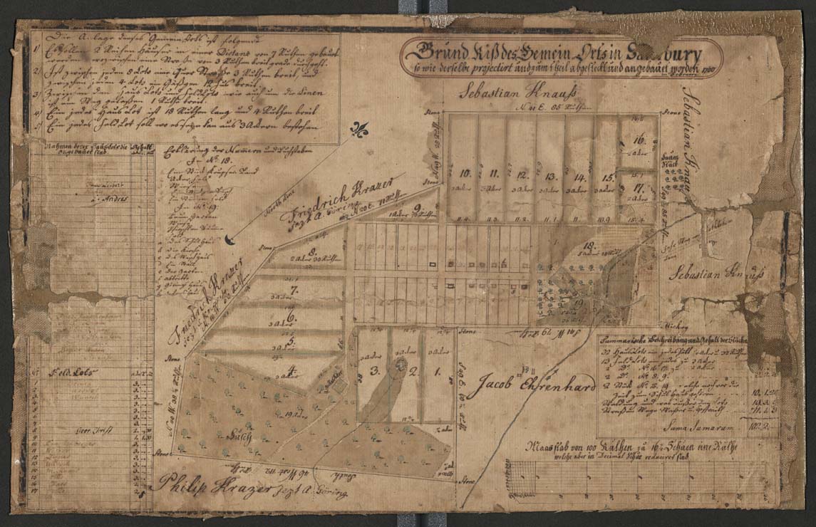
Town map of Salisbury (Emmaus) 1760
Item
-
Title
-
Town map of Salisbury (Emmaus) 1760
-
Alternative Title
-
Grund-Riß des Gemein-Orts in Salisbury so wie derselbe projectirt und zum theil abgesteckt und angebauet worden
-
Creator
-
Unknown
-
Date
-
1760
-
Description
-
Map of the town of Emmaus, formerly called "Salisbury," with references to changes in property ownership. Map created by a Moravian surveyor as a pen drawing on linen-backed paper.
-
Spatial Coverage
-
Emmaus, Lehigh County, Pennsylvania
-
Provenance
-
Moravian Archives, Bethlehem, Pennsylvania