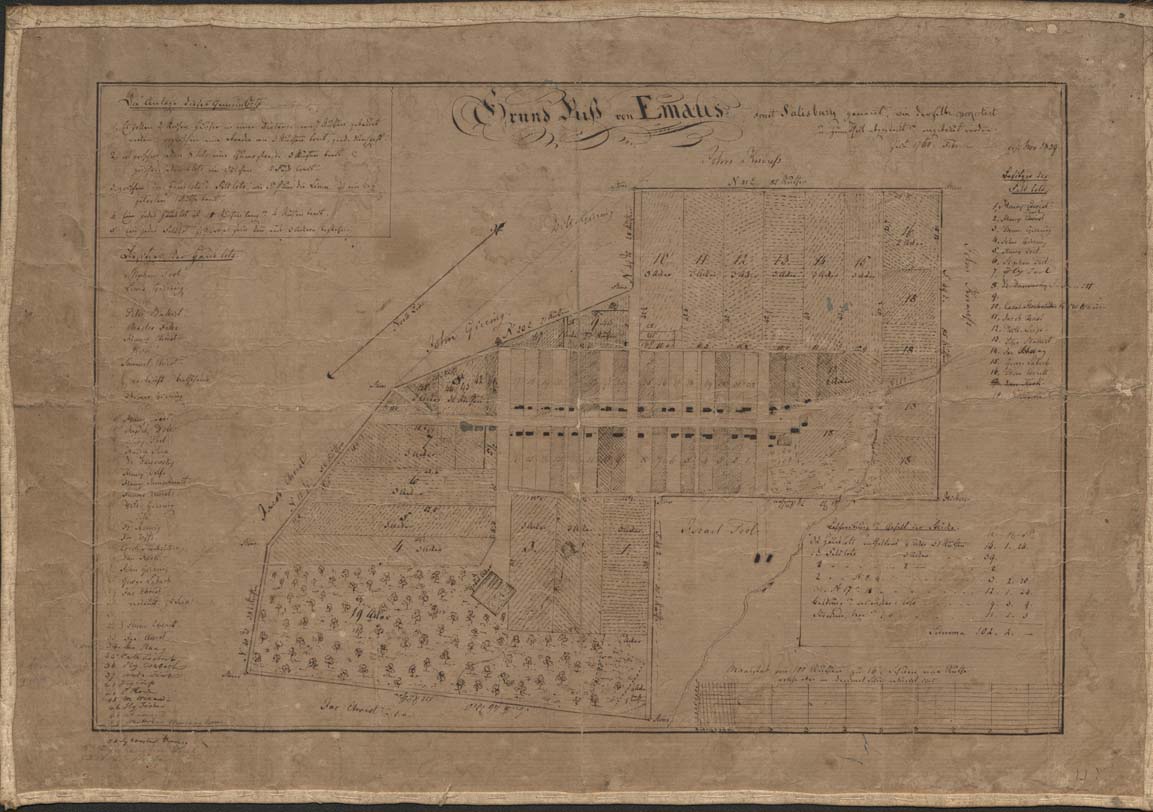
Town map of Salisbury (Emmaus) 1839
Item
-
Title
-
Town map of Salisbury (Emmaus) 1839
-
Alternative Title
-
Grund Riß von Emaus sonst Salisbury genannt, wie derselbe projectirt und zum Theil abgesteckt und angebaut worden seit 1760 Februar
-
Creator
-
Carl Friedrich Seidel
-
Date
-
1839
-
Description
-
Historical map of the town of Emmaus, formerly called "Salisbury," with references to changes in property ownership since the year 1760. The map is attributed to a Moravian minister, Carl Friedrich Seidel (alias Charles Frederick Seidel) based on handwriting analysis, who copied from early maps and created the map as a pen drawing on linen-backed paper.
-
Spatial Coverage
-
Emmaus, Lehigh County, Pennsylvania
-
Provenance
-
Moravian Archives, Bethlehem, Pennsylvania