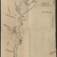
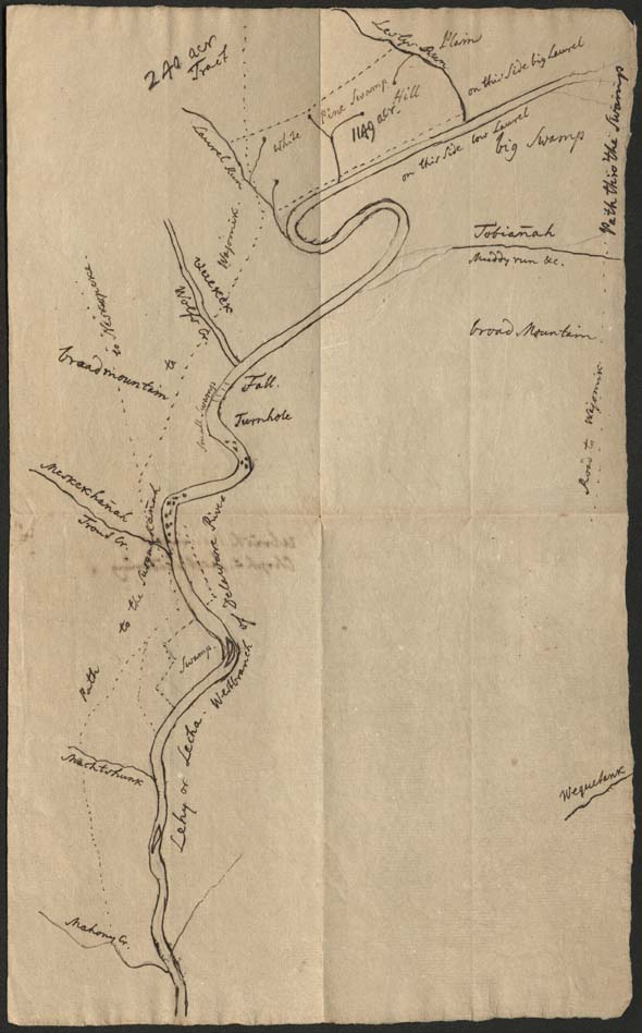
Map of waterways along the Lehigh River between the Mahoning Creek and Leslie Run
Item
- Title
- Map of waterways along the Lehigh River between the Mahoning Creek and Leslie Run
- Creator
- Johannes Ettwein
- Date
- 1775
- Description
- Pen-on-paper map of waterways along the Lehigh River north of Lehighton (then called Gnadenhütten). Map prepared by a Moravian minister. Date approximate
- Is Part Of
- Collection of Drawings and Prints
- Spatial Coverage
- Carbon County, Pennsylvania
- Provenance
- Moravian Archives, Bethlehem, Pennsylvania
- Item sets
- Historical Maps of the Lehigh Valley
- Site pages
- Digital Map Collections