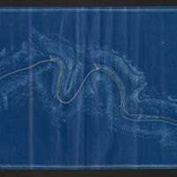
Portion of Map of the Lehigh Navigation from White Haven to Easton
Item
-
Title
-
Portion of Map of the Lehigh Navigation from White Haven to Easton
-
Creator
-
Lehigh Coal and Navigation Company
-
Date
-
1925
-
Description
-
Topographic map of a short portion of the entire Lehigh Navigation. This section runs from the Penn-Haven railroad junction at the confluence of Black Creek to the Lehigh River to Mauch Chunk. This item is a blueprint map copy dated November 27, 1925. Date of original unknown.
-
Spatial Coverage
-
Lehigh River, Penn Haven, Mauch Chunk
-
Provenance
-
Lehigh University Libraries, Special Collections
 21890.jpg
