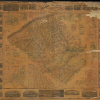
Map of Lehigh County, Pennsylvania
Item
-
Title
-
Map of Lehigh County, Pennsylvania
-
Creator
-
Aschbach, G. A.
-
Date
-
1862
-
Description
-
Wall map of Lehigh County, Pennsylvania. Along the outer edges of the map are numerous illustrations of notable locations within the county. Includes a chart detailing the 1860 census information for the county and townships, notes on the history of the county, and a table of distances between locations within the county. The map also has multiple inset maps of cities and towns within the county.
-
Publisher
-
Aschbach, G. A.
-
Contributor
-
Traubel, M. H., Lithographer
-
Spatial Coverage
-
Lehigh County (Pa).
-
Provenance
-
Lehigh University Libraries, Special Collections
 21923.jpg
