-
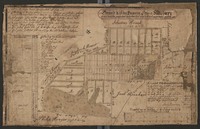 Town map of Salisbury (Emmaus) 1760
 Map of the town of Emmaus, formerly called "Salisbury," with references to changes in property ownership. Map created by a Moravian surveyor as a pen drawing on linen-backed paper.
-
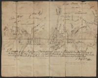 Survey of four tracts of land in Plainfield Township
 Survey of a 371-acre tract in Plainfield Township by a Moravian surveyor on behalf of Peter Oversheimer.
-
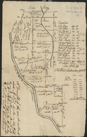 Survey of a sub-divided tract of land along the Lehigh River and Hokendauqua Creek
 Survey of a 1800-acre tract of land along the west branch of the Delaware River (today, the Lehigh River) sold by William Allen to Alexander Rickey and William Parsons, with explanation of the further subdivision of the tract. Included are property owners whose lands encompass modern-day Kreidersville, Northampton, and Coplay.
-
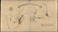 Map of the Nazareth Tract
 Cadastral map of the 5000-acre "Nazareth Tract," with some adjacent properties. Pen-on-paper map prepared by a Moravian surveyor and a Moravian ship captain. Date Approximate.
-
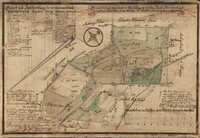 Map of tracts of land in Salisbury (Emmaus)
 Cadastral map of lands in Emmaus, formerly called "Salisbury," donated to the Moravian Church by Jacob Ehrenhardt and Sebastian Knauss, towards the creation of a new church settlement. Map prepared by a Moravian surveyor with and pen and watercolor on linen-backed paper.
-
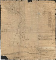 [Town plan of Bethlehem, Pennsylvania, with a legend of the various buildings]
 Town plan of Bethlehem of Bethlehem, with a legend ("Erklärung," in German) identifying buildings; likely prepared by a Moravian surveyor.
-
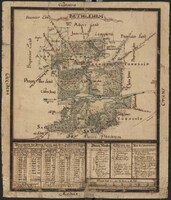 [Topographic map of Bethlehem, Pennsylvania, and surrounding tracts]
 Map of Bethlehem Tract and adjacent lands, prepared by a Moravian surveyor.
-
 [Plat map of Bethlehem lands on the south side of the Lehigh River]
 A cadastral map of South Bethlehem and surrounding area, indicating properties owned by the Moravian Church and others; prepared by a Moravian surveyor.
-
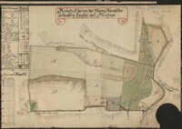 [Ground plan of the land and plantation purchased by Mary Burnside]
 A ground plan of Burnside Plantation, prepared by a Moravian surveyor.
-
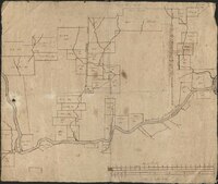 [Cadastral map of Lehigh Valley lands between Allentown, Bethlehem, Nazareth, and Easton]
 Cadastral map showing land holdings along the Lehigh River.
-
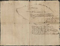 [Survey of land destined for a community north of Nazareth]
 A survey of the future land comprising the Village of Schoeneck, Village of Schoeneck, immediately north of Nazareth Borough, prepared by a Moravian surveyor in November 1760 and revised in November 1761.
-
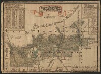 [Ground plan of the Nazareth Tract in Pennsylvania]
 A tapered, manuscript ground plan of the Nazareth Tract, dervived from a general plan of the same; a plan prepared by a Moravian surveyor.
-
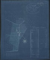 Draught of the Town and Land of New Nazareth in the year 1800
 Blueprint copy of a town plan prepared by a Moravian surveyor in 1800.
-
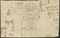 [Town plan of Nazareth, Pennsylvania]
 A manuscript town plan for the new city center of Nazareth, Pennsylvania, prepared by a Moravian surveyor.
-
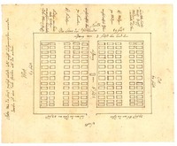 Map of the Moravian cemetery in Allemaengel (Lynn Township)
 Pen-on-paper cemetery map showing the layout of the cemetery of Allemaengel Moravian Church, with references to cardinal diections, the widths and lengths of sections and passageways, and to the ages and genders of persons buried in particular rows. A note on the left-hand side of the map indicates that the fence dimensions around the cemetery were inexact, because no measurements were made when the fence was erected.
-
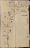 Map of waterways along the Lehigh River between the Mahoning Creek and Leslie Run
 Pen-on-paper map of waterways along the Lehigh River north of Lehighton (then called Gnadenhütten). Map prepared by a Moravian minister.
-
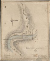 Map of Mauch Chunk (Jim Thorpe)
 Map of Mauch Chunk (Jim Thorpe) by cartographer Solomon White Roberts (1811-1882), executed as a pen and wash drawing.
-
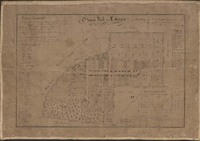 Town map of Salisbury (Emmaus) 1839
 Historical map of the town of Emmaus, formerly called "Salisbury," with references to changes in property ownership since the year 1760. The map is attributed to a Moravian minister, Carl Friedrich Seidel (alias Charles Frederick Seidel) based on handwriting analysis, who copied from early maps and created the map as a pen drawing on linen-backed paper.
-
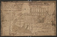 Town map of Salisbury (Emmaus) 1760
 Map of the town of Emmaus, formerly called "Salisbury," with references to changes in property ownership. Map created by a Moravian surveyor as a pen drawing on linen-backed paper.
-
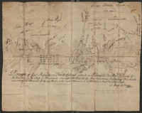 Survey of four tracts of land in Plainfield Township
 Survey of a 371-acre tract in Plainfield Township by a Moravian surveyor on behalf of Peter Oversheimer.
-
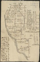 Survey of a sub-divided tract of land along the Lehigh River and Hokendauqua Creek
 Survey of a 1800-acre tract of land along the west branch of the Delaware River (today, the Lehigh River) sold by William Allen to Alexander Rickey and William Parsons, with explanation of the further subdivision of the tract. Included are property owners whose lands encompass modern-day Kreidersville, Northampton, and Coplay.
-
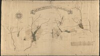 Map of the Nazareth Tract
 Cadastral map of the 5000-acre "Nazareth Tract," with some adjacent properties. Pen-on-paper map prepared by a Moravian surveyor and a Moravian ship captain.
-
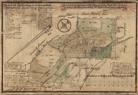 Map of tracts of land in Salisbury (Emmaus)
 Cadastral map of lands in Emmaus, formerly called "Salisbury," donated to the Moravian Church by Jacob Ehrenhardt and Sebastian Knauss, towards the creation of a new church settlement. Map prepared by a Moravian surveyor with and pen and watercolor on linen-backed paper.
-
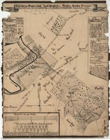 Map of the Ehrenhardt and Knauss properties in Salisbury (Emmaus)
 Cadastral map of Emmaus, formerly called "Salisbury," showing the Moravian Gemeinhaus (house of worship), lands owned by Jacob Ehrenhardt, and lands owned by Sebastian Knauss.
-
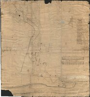 [Town plan of Bethlehem, Pennsylvania, with a legend of the various buildings]
 Town plan of Bethlehem of Bethlehem, with a legend ("Erklärung," in German) identifying buildings; likely prepared by a Moravian surveyor.
 Town map of Salisbury (Emmaus) 1760 Map of the town of Emmaus, formerly called "Salisbury," with references to changes in property ownership. Map created by a Moravian surveyor as a pen drawing on linen-backed paper.
 Survey of four tracts of land in Plainfield Township Survey of a 371-acre tract in Plainfield Township by a Moravian surveyor on behalf of Peter Oversheimer.
 Survey of a sub-divided tract of land along the Lehigh River and Hokendauqua Creek Survey of a 1800-acre tract of land along the west branch of the Delaware River (today, the Lehigh River) sold by William Allen to Alexander Rickey and William Parsons, with explanation of the further subdivision of the tract. Included are property owners whose lands encompass modern-day Kreidersville, Northampton, and Coplay.
 Map of the Nazareth Tract Cadastral map of the 5000-acre "Nazareth Tract," with some adjacent properties. Pen-on-paper map prepared by a Moravian surveyor and a Moravian ship captain. Date Approximate.
 Map of tracts of land in Salisbury (Emmaus) Cadastral map of lands in Emmaus, formerly called "Salisbury," donated to the Moravian Church by Jacob Ehrenhardt and Sebastian Knauss, towards the creation of a new church settlement. Map prepared by a Moravian surveyor with and pen and watercolor on linen-backed paper.
 [Town plan of Bethlehem, Pennsylvania, with a legend of the various buildings] Town plan of Bethlehem of Bethlehem, with a legend ("Erklärung," in German) identifying buildings; likely prepared by a Moravian surveyor.
 [Topographic map of Bethlehem, Pennsylvania, and surrounding tracts] Map of Bethlehem Tract and adjacent lands, prepared by a Moravian surveyor.
 [Plat map of Bethlehem lands on the south side of the Lehigh River] A cadastral map of South Bethlehem and surrounding area, indicating properties owned by the Moravian Church and others; prepared by a Moravian surveyor.
 [Ground plan of the land and plantation purchased by Mary Burnside] A ground plan of Burnside Plantation, prepared by a Moravian surveyor.
 [Cadastral map of Lehigh Valley lands between Allentown, Bethlehem, Nazareth, and Easton] Cadastral map showing land holdings along the Lehigh River.
 [Survey of land destined for a community north of Nazareth] A survey of the future land comprising the Village of Schoeneck, Village of Schoeneck, immediately north of Nazareth Borough, prepared by a Moravian surveyor in November 1760 and revised in November 1761.
 [Ground plan of the Nazareth Tract in Pennsylvania] A tapered, manuscript ground plan of the Nazareth Tract, dervived from a general plan of the same; a plan prepared by a Moravian surveyor.
 Draught of the Town and Land of New Nazareth in the year 1800 Blueprint copy of a town plan prepared by a Moravian surveyor in 1800.
 [Town plan of Nazareth, Pennsylvania] A manuscript town plan for the new city center of Nazareth, Pennsylvania, prepared by a Moravian surveyor.
 Map of the Moravian cemetery in Allemaengel (Lynn Township) Pen-on-paper cemetery map showing the layout of the cemetery of Allemaengel Moravian Church, with references to cardinal diections, the widths and lengths of sections and passageways, and to the ages and genders of persons buried in particular rows. A note on the left-hand side of the map indicates that the fence dimensions around the cemetery were inexact, because no measurements were made when the fence was erected.
 Map of waterways along the Lehigh River between the Mahoning Creek and Leslie Run Pen-on-paper map of waterways along the Lehigh River north of Lehighton (then called Gnadenhütten). Map prepared by a Moravian minister.
 Map of Mauch Chunk (Jim Thorpe) Map of Mauch Chunk (Jim Thorpe) by cartographer Solomon White Roberts (1811-1882), executed as a pen and wash drawing.
 Town map of Salisbury (Emmaus) 1839 Historical map of the town of Emmaus, formerly called "Salisbury," with references to changes in property ownership since the year 1760. The map is attributed to a Moravian minister, Carl Friedrich Seidel (alias Charles Frederick Seidel) based on handwriting analysis, who copied from early maps and created the map as a pen drawing on linen-backed paper.
 Town map of Salisbury (Emmaus) 1760 Map of the town of Emmaus, formerly called "Salisbury," with references to changes in property ownership. Map created by a Moravian surveyor as a pen drawing on linen-backed paper.
 Survey of four tracts of land in Plainfield Township Survey of a 371-acre tract in Plainfield Township by a Moravian surveyor on behalf of Peter Oversheimer.
 Survey of a sub-divided tract of land along the Lehigh River and Hokendauqua Creek Survey of a 1800-acre tract of land along the west branch of the Delaware River (today, the Lehigh River) sold by William Allen to Alexander Rickey and William Parsons, with explanation of the further subdivision of the tract. Included are property owners whose lands encompass modern-day Kreidersville, Northampton, and Coplay.
 Map of the Nazareth Tract Cadastral map of the 5000-acre "Nazareth Tract," with some adjacent properties. Pen-on-paper map prepared by a Moravian surveyor and a Moravian ship captain.
 Map of tracts of land in Salisbury (Emmaus) Cadastral map of lands in Emmaus, formerly called "Salisbury," donated to the Moravian Church by Jacob Ehrenhardt and Sebastian Knauss, towards the creation of a new church settlement. Map prepared by a Moravian surveyor with and pen and watercolor on linen-backed paper.
 Map of the Ehrenhardt and Knauss properties in Salisbury (Emmaus) Cadastral map of Emmaus, formerly called "Salisbury," showing the Moravian Gemeinhaus (house of worship), lands owned by Jacob Ehrenhardt, and lands owned by Sebastian Knauss.
 [Town plan of Bethlehem, Pennsylvania, with a legend of the various buildings] Town plan of Bethlehem of Bethlehem, with a legend ("Erklärung," in German) identifying buildings; likely prepared by a Moravian surveyor.